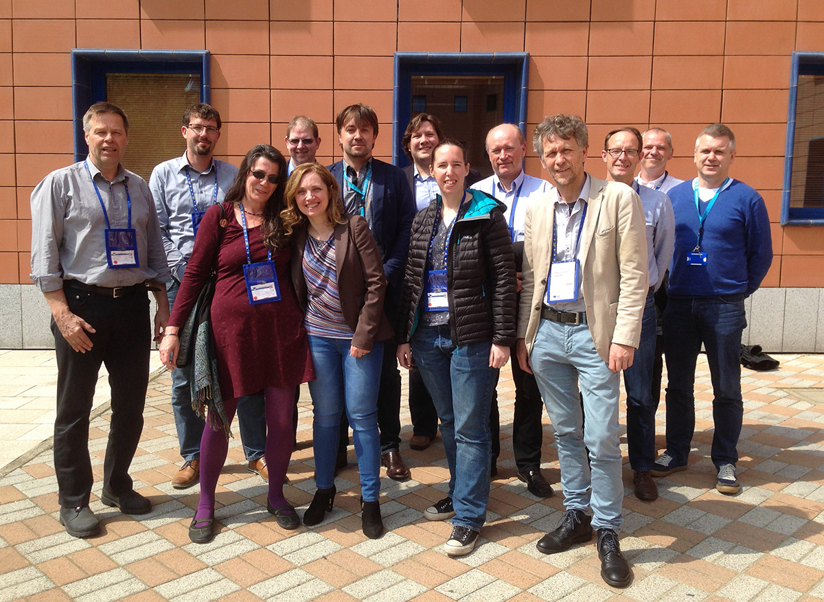
Advisory Board and Expert Group Meeting, 21st of April 2016, Ispra
We've invited the INSPIRE community to contribute to this project from day one, and we've now done our first meeting with the expert group as well as JRC and DG Environment representatives from the advisory board. We had ambitious objectives for this meeting:
- Ensure a common understanding of the goals of the project among stakeholders
- Get high-quality constructive input on structure and methodological aspects of the study
- Get contributions to build a resource that provides value to experts and the wider INSPIRE community

Meeting agenda and presentations:
- Context of the project (Jandirk Bulens)
- Meeting Introduction, Project Methodology and Implementation State (Thorsten Reitz)
- Expert Introductions (All)
- Summary of Survey results and Model inventory (Thorsten Reitz)
- The ELF project - Modelling Guidelines (Morten Borrebaek)
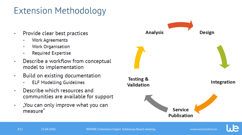
- Design Studio: The INSPIRE Extension Methodology (All)
- Model Presentations
- INSPIRE extensions: With examples from SOSI and INSPIRE Planned Land Use (Morten Borrebaek)
- Air Quality Reporting based on INSPIRE (Katharina Schleidt)
- The GeoSmartCity Data model (Stefania Morrone)
- Identify and name patterns in example models (All)
Notes from the meeting
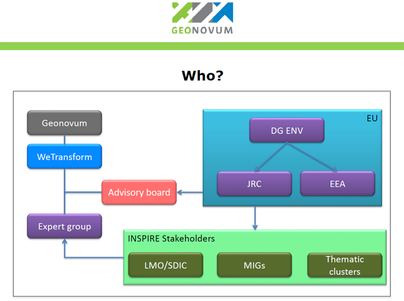
Jandirk Bulens (Geonovum) started with his introduction to the project, explaining the Why, What, How, Who and When. He explained that the project is an initiative of Geonovum and is carried out as an ad hoc project in the INSPIRE MIG-T (Technical Maintenance and Implementation Group) working program. This project is to be pragmatic and to produce results in a short period. It is an initial study and will result in recommendations for follow up. Robin Smith (JRC) added that the JRC plans a follow-up project to Are3na in an ISA2 action, a new four year program starting up this year, where they could include follow-up work. This will be important in the context of potential “refitting” work for INSPIRE guidance and specifications.

He also explained that a part of the project is a presentation at the INSPIRE 2016 conference. Robin and others appreciated this and advised to not only hold a workshop but also a presentation. Later in the day, they suggested a full track for the project results, best practices results and other related topics. The deadline for submission is 15th of May, so we have to be in time with a proposal.
Thorsten Reitz then introduced the approach selected for the project, initially identified extensions, patterns and survey results. He explained that all results of the study are shared on this site. Everyone is explicitly invited to contribute directly to the study. Thorsten showed how to contribute.

Next, Thorsten presented the survey results. At the first cutoff date of 20th of April, we had 66 responses and reported 19 models, of which 11 are publicly documented and 8 with an open license. Three key takeaways from the survey:
- In the design phase, respondents mostly struggle with the extension methodology. Even experts state that they need guidance on this process.
- In the implementation phase, the number 1 issue is systems integration, followed by data transformation.
- The survey participants mostly create INSPIRE extensions because they want to improve external processes such as reporting to other organisations, not just because it’s a legal obligation.
After the respondent has given approval, wetransform published the models on the study website. The survey continues until the end of the project until the 1th of July. The results on the website are updated regularly. Not included yet are the 29 extensions included in the annexes of the data specs. These will be added after entry in the survey, so that required information is available.
Expert presentations
After the coffee break the experts introduced themselves and presented their first thought and experience on the subject:
- Paul Janssen (Geonovum, NL) introduced the Domain model of Cables and Pipelines, which uses Mixin (multiple inheritance) combine existing models with INSPIRE.
- Morten Borrebaeck (Kartverket, Norway/ELF) explained how they as a National Mapping and Cadastral Agency have used standardisation. Morten also presented the modelling guidance which was set up in the ELF project.
- Debbie Wilson (Ordnance Survey, UK) presented Ordnance Survey experiences up to date with extending on INSPIRE and came up with some general rules. The first implementation took 2 years, now reduced to approx. 9 months.
- Kathi Schleidt (UBA Austria) referred to what is missing in the process, the data model harmonization, the more people the more chaos, and standards not necessarily mean easy interoperability. Kathi also presented her experiences creating the model for the e-Reporting on Air Quality. The AQ-model imports multiple themes and has more requirements come from the Air Quality directive. Her conclusion was that INSPIRE provides the building blocks for reporting, but also that feature types had to be extended. Nevertheless the synergy of INSPIRE at one side and the AQ reporting requirements on the other side do influence each other resulting in a better coverage.
- Stefania Morrone presented their workflow and two model extensions (Buildings 2D-Energy, Extended Utility Networks) built in the GeoSmartCity project.
Drafting patterns
The next question we addressed was about what a pattern needs to be to be helpful, and how a designer would select one using the guidance. These are the criteria we have come up with:
- Complexity (just properties, or also objects or more?)
- Type of extension
- Relation to models already in use
- Enable a consistent model through schema transformation
- Balance conceptual model clarity and implementation platform concerns
Drafting the extension process
After lunch we started a methodology Session in which we used the Design Studio methodology to define the process of creating an INSPIRE-related data model. All experts and project members were involved and each was asked individually to describe the steps to be taken in the process to create an INSPIRE Extension. In the following round each of the participants presented their steps, not repeating steps already mentioned before. Stefania contributed the framework that GeoSmartCity had developed, which we used as a base for further work. This framework process looks as follows:
- Collect requirements:
- Create a template file in order to collect the users’ data modelling requirements in a structured way.
- Request each pilot to provide the list of information (attributes, code list ..) needed to run its use cases.
- Analyse and Compare:
- Align different pilots’ data modelling requirements (whereas feasible, group requirements into common classes)
- o Compare data requirements so collected to the relevant INSPIRE Data Specifications
- Extend data models:
- Provide an extension of the INSPIRE data models to take into account requirements not covered by the INSPIRE DS
- Provide detailed instructions for maintenance of the schemas and the revision loop
- Validate results:
- Successfully validate the produced schemas against encoding requirements using desktop (Oxygen) and online (OGC CITE test Suite) tools
Wrapping up
The participants concluded that the meeting was fruitful. We realized it is important to keep focus. Making the scope broader will increase complexity and the risk to loose a clear result within the time set for the study. Nevertheless what is recognized as important to address should be included in the recommendations as a follow up for this study. The next expert meeting should be a two-day meeting in order the have enough time to finish essential discussions. The date for the next meeting is set for Wednesday 29th and Thursday 30th of June. We will meet at the JRC in Ispra.